Myanmar Earthquake will not have impact on Bangladesh
A moderate 5.3-magnitude earthquake rocked Myanmar's coastal waters in the Andaman Sea this morning, just hours after four tremors rattled Bangladesh over the past day.
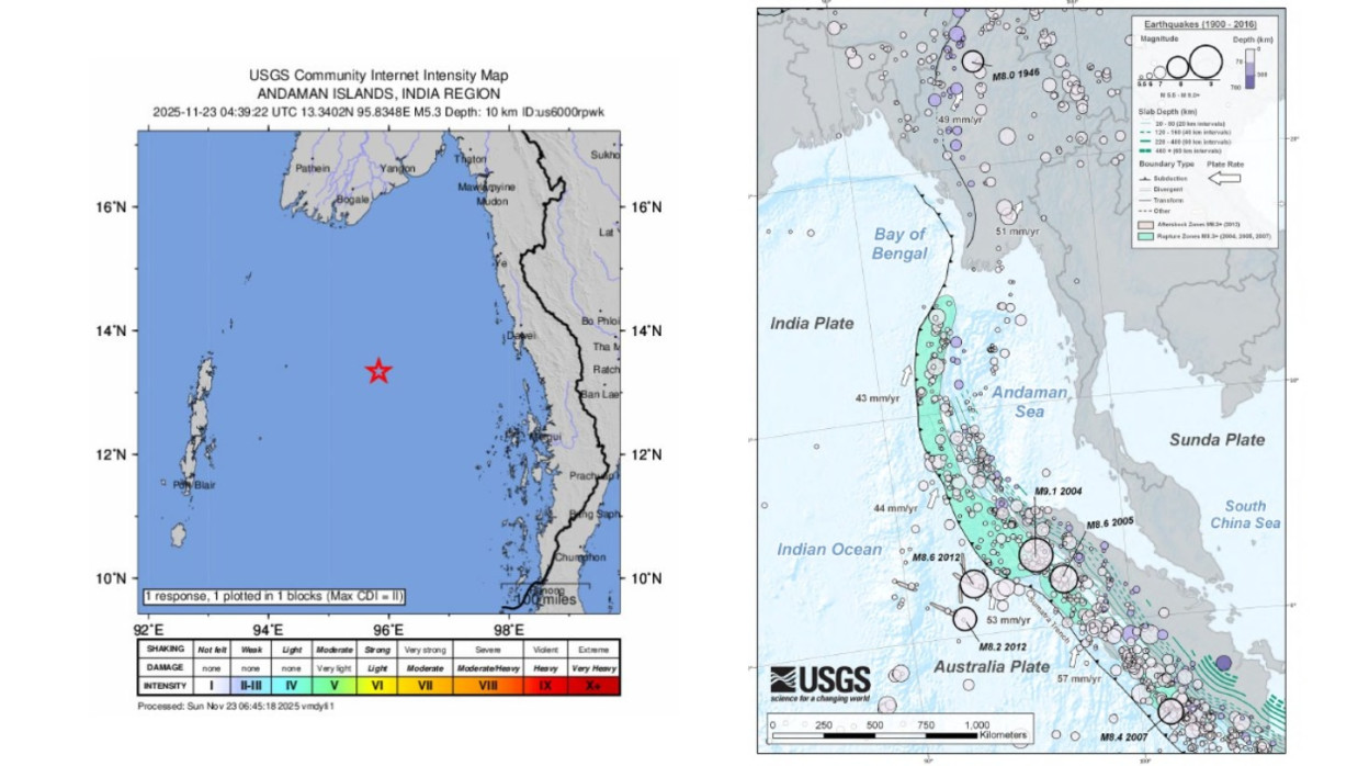
The quake struck at 10:39am Bangladesh time on Sunday (23 November), with its epicentre located about 267 km west-southwest of Dawei city in Myanmar, according to the US Geological Survey (USGS).
The tremor occurred at a shallow depth of 10 km and was felt in coastal Myanmar regions, but no immediate reports of casualties or damage have emerged.
Link to Bangladesh quakes?
The event occurred on a different geological fault from Bangladesh's recent activity. USGS data shows it was unrelated to the 5.7-magnitude main shock in Narsingdi on Friday (21 November), which killed at least 10 people and injured hundreds.
Saturday saw three mild aftershocks in Bangladesh, including a 3.3-magnitude tremor in Narsingdi's Palash area at 10:36am. Experts say the Myanmar quake is too distant (over 1,000 km southeast) to influence local faults, but it underscores regional seismic unrest in the Indo-Burman subduction zone.
Mostofa Kamal Palash, a meteorologist, noted: "The Myanmar event was east-facing on a separate plate boundary. No impact expected on Bangladesh faults."
Regional context Myanmar lies on the highly active Sagaing Fault and Indo-Burma megathrust, prone to frequent quakes. The Andaman Sea region saw a 5.4-magnitude event on 9 November, felt in India's Andaman and Nicobar Islands.
In Bangladesh, the Friday quake remains the deadliest in decades, with ongoing aftershock risks. Authorities urge vigilance in high-risk districts like Dhaka, Narsingdi and Gazipur.