Bay Low Pressure Turns Cyclone: Squally Winds to Lash Bangladesh Coast
- ০১ অক্টোবর ২০২৫, ১৪:৫২
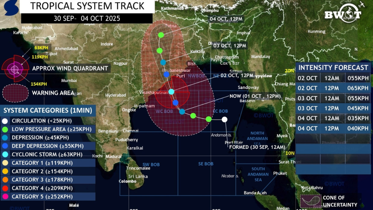
A well-marked low pressure over the west-central Bay of Bengal and adjoining areas has intensified into a depression in the same region. It is likely to gain further strength and develop into a normal cyclone. The Bangladesh Weather Observation Team shared this information in a post on Wednesday (1 October).
Weather data indicates that the well-marked low pressure over the west-central Bay of Bengal and adjoining areas has further intensified into a depression in the same region. It may move further northwest and become a deep depression within the next 12 hours.
It further states that within the next 24 hours, it may gain further strength and develop into a normal cyclone. It could cross the south Odisha coast tomorrow night. Though there will be no direct impact on Bangladesh, squally or gusty winds of 35 to 55 km per hour may blow over Bangladesh's coastal areas on 2-3 October due to its influence.